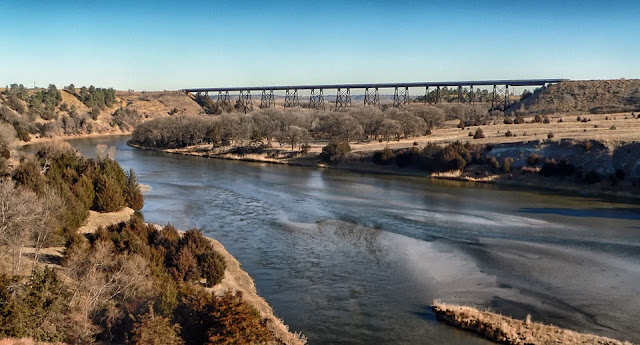
Description - Nebraska is a mainly rural state with most of the population living in the southeastern portion of the state. This region contains the large communities of Omaha, Lincoln (the capital), Grand Island and Hastings. The eastern border of the region is formed by the Missouri River. This is the region where European descendants first settled the state. Waters from many rivers and streams irrigate prolific agriculture lands that include the Arbor Day Farm orchards. The green areas of several state parks complete the landscape in this region and provide access to recreation opportunities for residents and visitors.
The Prairie Lakes region of Nebraska lies in the southwestern area of the state. This once was a dry landscape of tallgrass prairies and cattle drives. Today several reservoirs have been created, in the region, with recreation areas along their shores. The state recreation areas surrounding the reservoirs contain marinas, campgrounds, picnic grounds and hiking facilities.
The Platte River corridor leads through southern Nebraska from west to east. Interstate 80 closely follows the river's path, as did the emigrants on the Oregon Trail, Overland Stage Route and Santa Fe Trail. State parks, historic sites and recreation areas line the river banks throughout the region. Lake McConaughy State Recreation Area lies within this corridor in western Nebraska. The reservoir is the largest in the state with 36,000 acres of water.
Northwestern Nebraska includes the area north of Interstate 80 to the northern border. This region contains some unusual rock formations, that tell visitors that they are in a geologic transition zone. The plains are slowly blending into the foothills of the Rocky Mountains. This territory continues for several hundred more miles before it reaches mountainous terrain. Attractions like, Agate Fossil Beds and Scotts Bluff National Monuments, interpret the changing landscape. A portion of Nebraska National Forest and all 95,000 acres of Oglala National Grasslands preserve open space for recreational and educational purposes.
North central Nebraska is characterized by scattered pines, sandstone canyons and high prairies. This region contains two districts of the Nebraska National Forest and two National Wildlife Refuges. A portion of the national forest contains an experimental pine forest that is considered the largest man-made forest in the United States. The Niobrara River flows through the region toward the waters of the Mississippi.
Northeastern Nebraska is known as the Land of Lewis and Clark, because the duo's expedition tromped through the region as they explored the Missouri River. Three Indian Reservations exist within this area, that of the Sioux, Winnebago and Omaha Tribes. Several state parks complete the landscape of public lands in this region.
Read: Best Hiking child carrier backpack for 2 year old
Recreation - As unusual as this may seem, many of the recreation areas in this state lie on the banks of waterways. Large reservoirs pervade the state and provide facilities for hiking, biking, camping, boating, water skiing and canoeing.
Climate - Nebraska has a moderate climate with high humidity. The relative humidity in this state averages 70 percent throughout the year. Winter temperatures normally average between 20 and 45 degrees F. March brings warmer weather and temperatures above freezing for most of the month. Spring is in full swing by late April when temperatures often reach above 60 degrees F. Summer temperatures reach highs of 95 degrees F frequently, with warm weather continuing into mid September. Crisp fall weather truly begins in October when nighttime temperatures begin to dip into the low 40s. The wettest time of the year in this state is late spring through summer.

Comments
Post a Comment